Oak Ridge Forest
Collinsville, AL 35961
DeKalb County, Alabama
Ranch Description
Oak Ridge Forest is a recreational tract in the Appalachian Mountains featuring the following attributes:
-Scenic setting with natural stands of mountain hardwoods
-Ample mast-producing oaks providing food and habitat for deer, turkey, and other wildlife
-Convenient location just minutes from Interstate 59 (Exit 205) and 5 minutes from Collinsville
-Just minutes from Lake Weiss and the Coosa River, and less than 40 minutes from the Tennessee River and Lake Guntersville
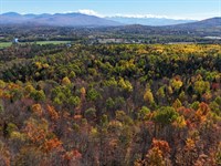
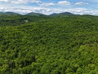
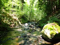
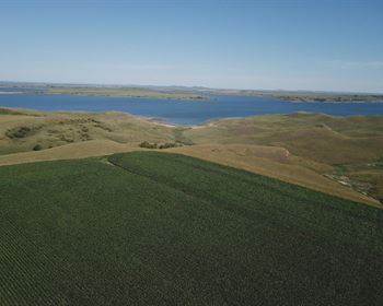
The Oak Ridge Forest is located in Northeast Alabama's southernmost reaches of the Appalachian Mountains. In this region, valleys are cultivated for farming or timber production, while ridges support natural stands of mature mountain hardwoods.
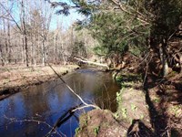
The tract is surrounded by timber-producing properties and a gravel operation to the east. Lake Weiss and the Coosa River are only minutes away, and the Tennessee River and Lake Guntersville are less than 40 minutes from the property. The surrounding Appalachian landscape offers a wide range of recreational opportunities connected to nearby state and national parks.
Interstate 59 is only minutes away at Exit 205, where fuel, lodging, and dining options are available. The community of Collinsville is a 5-minute drive north and provides additional fuel and dining. Fort Payne, Alabama, is about 14 miles north, directly off the interstate, and offers hotels, restaurants, groceries, and a major medical center. Several small airports serve the area.
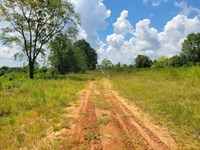
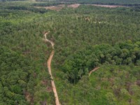
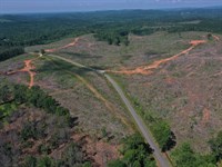
Currently, the property is accessible only by permission through adjoining tracts. Showings must be scheduled in advance to ensure that neighbors are notified appropriately. The primary access route is via South Valley Avenue through a county owned parcel to the east that is being mined for gravel. The tract has direct access to electricity. Internal trails were created during the 2009 harvest; while some have become overgrown, portions remain passable by ATV and could be improved for future use.
This tract has been managed for timber production under the current ownership. Access is presently by permission across neighboring properties, but if legal access can be secured, the property could also be suitable for residential development.
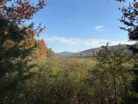
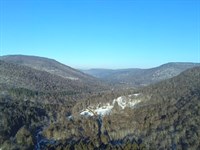
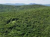
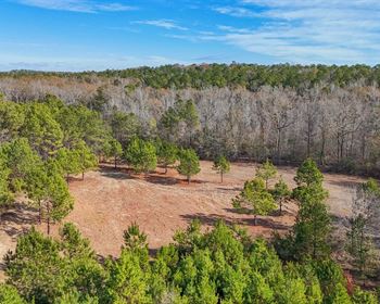
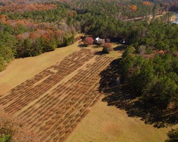
The terrain is hilly, with elevations ranging from 800 to 1,200 feet. Soils are well-drained and highly suitable for timber production, although some slopes may require specialized equipment. As shown in the photos, the ridgetops provide impressive views of surrounding mountain ridges and valleys. The property supports a rich variety of oak species in both younger and older stands, producing abundant acorns that enhance its wildlife and recreational value.
Approximately 74 acres were harvested in 2009, and the area has since regenerated naturally. The 16-year-old stand is now a mix of hardwood and pine species that has not yet reached merchantable size. For timber production objectives, this stand should be allowed to continue growing until it becomes marketable, which is typically around 30 years of age for naturally regenerated timber.
Because of the property's steep terrain, harvesting may require specialized rough-terrain logging equipment. For future production, replanting with improved loblolly pine at lower densities is recommended, as thinning may be difficult on slopes and sawtimber markets are projected to remain strong.
Older patches of hardwood remain on the property and may provide selective harvest opportunities as the younger stands mature. For buyers not focused on timber management, the tract is well-suited to remain in natural regeneration. Over time, oak and hickory species are expected to dominate, providing strong wildlife habitat and recreational appeal.
Ranch Maps & Attachments
Directions to Ranch
The tract is accessible just minutes from exit 205 on I-59. Access is by permission, so it will be shown by appointment only. Please call, text or email to schedule a showing and get directions.
More Ranch Details
More Ranches from Thom Milke
 582 AC : $1.92M
- 87.7 AC : $203K
- 54 AC : $850K
- 238.1 AC : $595K
- 515 AC : $705K
- 91.1 AC : $462K
- 256 AC : $920K
- 1,184 AC : $2.87M
- 241 AC : $2.9M
- 270 AC : $800K
- 88.5 AC : $359K
- 130 AC : $261K