Beautiful Off Grid Land with Views
Rome Hwy : Rome, OR 97910
Malheur County, Oregon
Ranch Description
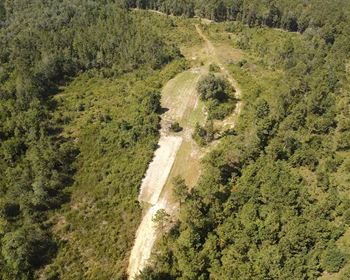
80 Acres in Malheur County, Oregon - Remote Range Land Escape
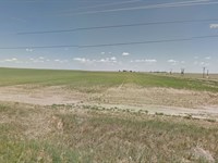
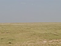
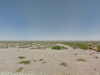
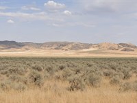
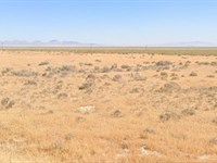
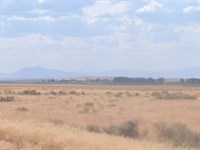
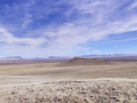
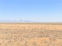
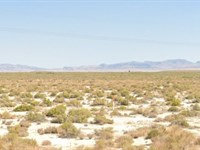
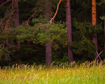
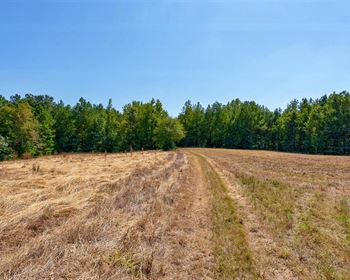
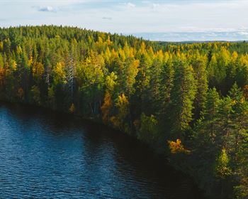
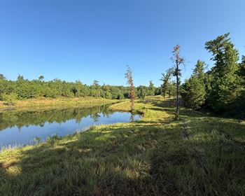
Looking for wide open space far away from the hustle of modern life? This 80-acre property in Jordan Valley, Malheur County, Oregon is a true off-grid retreat. Located roughly 18 miles off Highway 95, this parcel is surrounded by vast rangeland and bordered by Bureau of Land Management (Blm) land, offering unlimited opportunities for camping, hiking, hunting, and exploring the rugged outdoors.
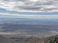
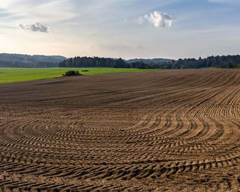
Malheur County is Oregon's second largest county by land area, known for its wide-open high desert, rolling hills, and agricultural heritage. The Jordan Valley area in particular is prized by outdoor enthusiasts for its isolation, wildlife, and expansive public lands.
This parcel is zoned C-A2 Exclusive Range Use, making it well-suited for agricultural, grazing, or recreational purposes. Please note: county zoning requires 320 contiguous acres for a residential dwelling, so this property is not suitable for building a home. It's best enjoyed for recreation, hunting, camping, or as a land investment.
Property Highlights
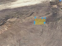
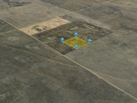
Size: 80 acres (two diagonally adjacent 40-acre parcels)
Location: Jordan Valley, Malheur County, Oregon - approximately 18 miles from Hwy 95
Scenic Views: Expansive high desert rangeland with surrounding BLM public lands
Terrain: Varied desert terrain, elevation approximately 4,125 ft
Roads: Dirt access, well off the beaten path
Utilities: None - rural/off-grid (solar, generator, or cistern required if developed for non-residential uses)
Area Highlights
Malheur County is rich in Oregon Trail history and known for its ranching and agriculture. Jordan Valley is a small rural community with strong Basque heritage and western charm.
Nearby towns include Jordan Valley (~20 miles), Nyssa (~90 miles), and Winnemucca, NV (~120 miles). Boise, ID is the nearest metro center, about 95 miles northeast.
This region is popular for big game hunting, upland bird hunting, camping, off-roading, and horseback riding. Antelope, mule deer, coyotes, and raptors are frequently spotted.
Why Choose This Property?
Affordable entry into large-acreage ownership at under $15,000.
Direct access to thousands of acres of BLM land.
Perfect for hunters, campers, or those seeking extreme solitude.
Flexible seller financing available with only $1 down and $199 doc fees
Be sure to reference L100266-1 in any correspondence.
$1 down payment and $199 document fee for lot L100266-1. Your welcome packet, contract, and digital payment coupon book for your monthly payments will be sent to the shipping address you provide. (Please note that we do charge a shipping fee.)
This information contained in this listing is deemed reliable, but not guaranteed. Amato-Y, LLC (Dba is not responsible for the accuracy of this information. The buyer is responsible for verifying all information with the county. The land is being sold "as-is" with no warranties either expressed or implied as to the location, condition, accessibility, terrain, build-ability, or information contained in this listing. Sizes advertised are approximate. Buyers are required to perform all due diligence prior to making a down payment. By buying you are acknowledging that you have completed all due diligence and that you understand legal commitment to purchase. Dollar Land Store does not issue refunds, Once you have completed your due diligence and are prepared to purchase a property you may make the down payment on the property; however, if you decided not to keep the property or terminate the "standard agreement of sale," the deposit, document fees, and any payments are non-refundable. Please review the Dls: Terms and Conditions Prior to purchase.
Ranch Maps & Attachments
Directions to Ranch
Start in Rome, Oregon (which lies near U.S. Route 95 in Malheur County)
Head south / southeast on US-95 (depending on exact roads available)
You'll likely follow US-95 until you can connect onto smaller local roads heading east toward your longitude -118.11744
As you branch east, you may need to use county roads, forest roads, or BLM roads to reach the precise point (42.52726, -118.11744)
Continue adjusting course east or west and north/south as needed, following topographic features, local road networks, and maps or GPS guidance
Arrive at (42.52726, -118.11744)
More Ranch Details
More Ranches from Ross Amato
 46.3 AC : $48.9K
- 35 AC : $25K
- 653.3 AC : $249K
- 10 AC : $9K
- 39 AC : $20K
- 39.1 AC : $20K
- 39.5 AC : $20K
- 37.4 AC : $20K
- 36.9 AC : $489K
- 38.1 AC : $20K
- 37.8 AC : $20K
- 37.8 AC : $20K