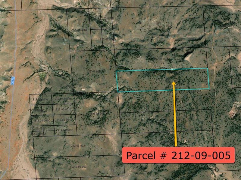
40 Acres NE of Concho, AZ
Concho, AZ 85924
Apache County, Arizona
Ranch Description
40 Acres NE of Concho, AZ - Property has lack of right of access.
Great off grid property for summertime RV'ing or year round living.
Property Address: NE of Concho, Az
Latitude/Longitude: 34.545218, -109.558838
County: Apache
Directions: Unknown
CASH Price: Plus closing costs
Apache County Assessed Land FCV (Full Cash Value) uses: Single Family Homes, Manufactured Homes, Mobile homes (15 years or newer) and RV's allowed. General agriculture: breeding, raising, training, and feeding of horses, cattle, sheep, goats, hogs, and poultry provided that new pens, buildings, and corrals are not closer than fifty (50) feet from any adjacent residential property line on and after the effective date of this Ordinance.
Property Description:
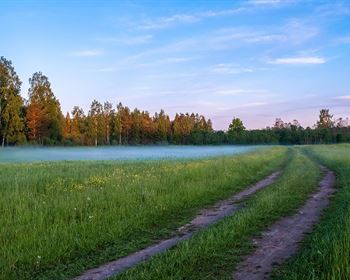
Come take a look at this remote 40 acre parcel northeast of Concho AZ. Located in the high deserts, on North East portion of Arizona, this is a great place to get away from it all, to call your own. So load up the family and head to your own piece of Arizona property with your RV and off-roading toys for the summer, or set up your off grid home away from the city life. Surrounded by the great outdoors there is endless hunting and fishing opportunities (some of the best big game hunting units are located in this area of Arizona). Show Low, Arizona is only an hour away with Walmart Supercenter, fine dining. shopping, entertainment and many other amenities available. This is a great opportunity to own a piece of Arizona land of your own for a private getaway or as a future investment
Property Info
Power: None
Sewer: None
Water: None
Gas: None
Telephone: None
Cable: None
Permits: None
Fence: None
Access: Landlocked
HOA: No
Survey: None
CCR's: None
Property Details
Parcel Number: 212-09-005
Account Number: R0053867
Property Type: VAC Undetermined Rural Non-Subdivided
Lot Size: 1,840,252 sqft
Acres: 42.246 acres
Topography: Rolling
Dimensions: 2838'X645'x2835'x656'
Shape: Rectangle
Zoned: Agricultural
FEMA Flood Hazard Zone: Zone D
Fema Floodway: No
Yearly Tax Amount: Type: None
Road Maintenance: None
School District: Sanders Unified District
Legal: Section: 11 Township: 13N Range: 26E S2 S2 NW4