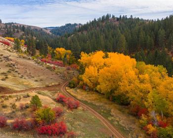
Freestone Hill Forest
Bridgewater, VT 05091
Windsor County, Vermont
Ranch Description
Freestone Hill represents an excellent timber investment opportunity with attractive species composition, well-drained soils on sloping terrain and diverse diameter distribution, including maturing stems, ensuring a regular, periodic flow of income from future forest management activity.
The ownership, The Conservation Fund (Tcf), is a non-profit conservation organization whose Mission Statement is “Tcf, working with public, private and nonprofit partners, protects America's legacy of land and water resources through land acquisition, sustainable community and economic development, and leadership training, emphasizing the integration of economic and environmental goals”. Their goal in divesting is to raise funds to further their forestland conservation work on new projects.
Investment highlights include:
- Long-term timber investment opportunity with high-quality timber resource
- Ideal species composition, dominated by sugar maple, yellow birch, ash and red spruce
- Developed access, well suited to future forest management activities
- Standing timber value representing 93% of the asking price
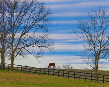
- Attractive location with recreational opportunity supported by various sites to build a camp
- Option Agreement held by the seller to acquire a conservation easement on the land, creating an income opportunity for the new owner within a 10-year period
Location
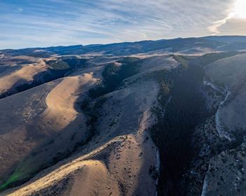
Freestone Hill Forest is located in a mountainous region of central Vermont, which is, surprisingly, sparsely developed, given its close proximity to some of the state's most popular destinations. Known as the Chateauguay-Notown Region, this scenic area has a rich working landscape heritage, as evidenced by the numerous stone walls and cellar holes that cover the hillsides. In the late 19th century, there was even a brief gold rush episode. Now the area is largely forested and hosts the Appalachian Trial.
The Chateauguay-Notown Region covers nearly 60,000 acres and is bounded by Route 12 to the east, Route 4 to the south, Route 100 to the west, and Route 107 to the north. The property is located in the area's south-central section. Because of its undeveloped nature, the region has been the focus of many conservation groups and individuals who have worked to protect its unique landscape. To date, over 30% of the area has been protected from development by various means (see location map for designation of protected lands in the region). The region's scenic and natural significance has also made it a coveted place for investment.
The township of Bridgewater, the home of Freestone Hill Forest, largely falls within the Chateauguay-Notown Region. The majority of Bridgewater's population and residences are within the small village of Bridgewater along Route 4 (5 miles from the property). Bridgewater was historically a woolen mill village; today, it is an artist and tourist community that is still populated by well-settled, year-round residents as well as a new population of second home dwellers. Further west along Route 4, the hamlets of Bridgewater Corners and West Bridgewater each offer a general store for locals and the many travelers along this popular east-west corridor. The village of Woodstock, a renowned all-season tourist destination, is 11 miles east of the property, while Killington Mountain Resort is 9 miles to the west.
Route 4 connects Bridgewater to major metropolitan areas via Interstate 91 to the east (Boston is 2.5 hours southeast) and Interstate 87 in New York to the west (New York City is 4.5 hours southwest).
Access
The southern half of the property is accessed by Baker Hill Road which is a Class IV, non-town-maintained road that is well suited for future forest management activities. This dirt road runs along a narrow valley paralleling Cold Brook. There is ±1.320' of frontage along the road. The road then heads off the property before returning back to provide access to the northeastern section of the land.
The northern side of the property is accessed by Chateauguay Road, a town-maintained Class III road. There is ±3,120' of frontage on both sides of this road. An established driveway access runs off the road on each side of the road frontage. Forestry trails lead from the various road frontage points, covering the entire property.
Site Description
The property is divided nearly in half by a ridge that runs west to east. The southern portion of the land, which is accessed by Baker Hill Road, encompasses Freestone Hill (elevation 2,084' ASL (above sea level)). Other than some steeper slopes along the road frontage, the terrain on this side of the property is moderately sloping.
The northern half of the land consists mostly of steeper slopes that rise to the height of land on each side of Chateauguay Road. While the slopes are fairly steep, the soils are highly productive and well drained, perfectly suited to the development of high-quality hardwood sawlogs.
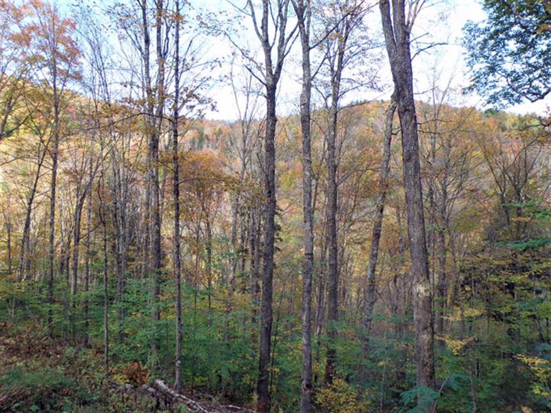
Overall, the land's well-drained soils produce some of the best sugar maple in the region. There are no notable wetlands on the property given its steadily-sloping terrain.
At the land's northern end, the headwaters of the Ottauquechee River, a clear water stream with boulders and deep pools, runs through the property. This end of the land offers the greatest opportunity for camp construction (with appropriate setbacks from the stream and approval from the Seller per the Option Agreement), given the existing established driveways off Chateauguay Road. There is no electric power along this road; the widely scattered homes in the area (some year-round and some seasonal) are off grid.
Timber
Timber data in this report are based on a timber inventory conducted in the fall of 2018 with growth for the 2019 and 2020 growing seasons. The data reveal a total sawlog volume of 2,280 MBF International ¼” scale (3.7 Mbf/Acre) and 9,047 pulpwood cords (14.6 cords/acre). Combined total per acre volume is 21.9 cords, a figure reflecting the regional average. Stumpage values were assigned to the volumes in March of 2019 producing a property-wide Capital Timber Value (Ctv) of acre).
A species composition dominated by hardwoods prevails, with hardwoods at 94% and softwoods at 6% of total volume. Species composition for all products combined offers a favorable mix led by sugar maple at 52% of total volume, followed by yellow birch at 15%, and other common northern hardwoods and red spruce as associates making up the balance. The sawlog volume breakdown consists largely of species with historically strong demand, dominated by sugar maple, white ash, yellow birch and red spruce.
Overall, forest stocking is variable, with stocked to overstocked conditions in previously untreated units and ideally stocked conditions in areas more recently thinned. Natural regeneration has become fully established in areas that were previously thinned well over a decade ago. Average Basal Area (Ba) is 90 square feet.
Average diameter for all products combined by volume is 14”, while the average sawlog diameter is 15.5”. Average diameters for the three major species are sugar maple 16”, yellow birch 15.5” and white ash 15”.
Special Features
The timber data reveal a gross tap count of 32,998 (53 taps/acre). Assuming that 75% of the gross taps are suitable for use in a sugarbush, net taps are estimated to be ±25,000. 92% of the taps are sugar maple.
The tap density appears to be suitable for a commercial operation; however, due to various watersheds, it will be necessary to have 2 or more collection sites. In addition, electric power is not available near the sap collection sites.
Easement
The seller is retaining an option over the next 10 years to acquire a conservation easement covering the property from the new owner. This Option will allow the seller to purchase a conservation easement at a value of 75% of the fair market value of the conservation easement (based on appraised value), at the time the option is exercised. This Option offers the new owner an active partner who will work to secure the necessary funding to purchase the easement, providing an alternative revenue source during their ownership tenure. During the 10 year option term, the owner shall maintain the land's enrollment in the Use Value Appraisal program in good standing and not develop or subdivide the land unless mutually agreed upon with the option holder.