Bordering Blm Land & Road Frontage
County Road 541 : Walsenburg, CO 81089
Huerfano County, Colorado
Ranch Description
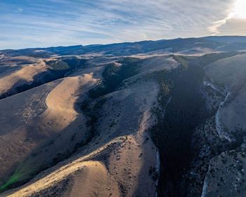
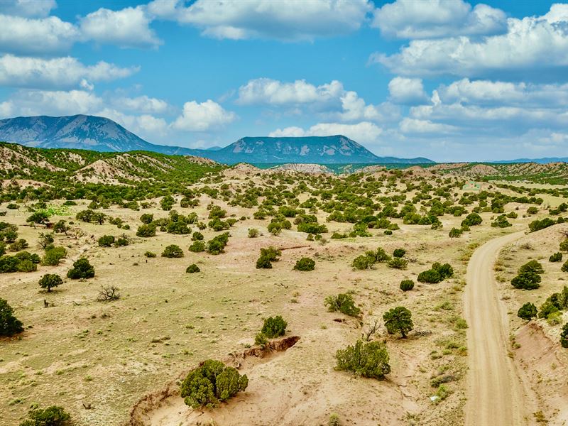
70 Acres in Colorado with Mountain Views, 0.2 miles (1,045 feet) of County Road Frontage along the Northern boundary and bordering approximately 200 Acres of BLM Land along the Southern boundary.
Call or Text anytime for questions or to purchase this property. Please reference the Property ID: Co_Huerfano_00073
Financing is Available for the Property with a Down Payment of as little as and Monthly Payments as low as The Deposit to secure this property is credited towards your down payment leaving only due at Closing. There are NO Additional Closing Fees. There is NO Pre-Payment Penalty, so you may pay it off at any time. You do not have to wait till the property is paid off to start enjoying it. You may start enjoying the property upon completion of the paperwork and receipt of your down payment.
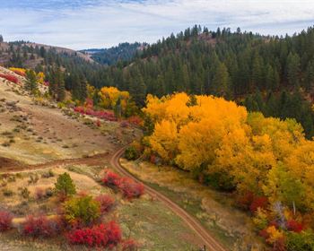
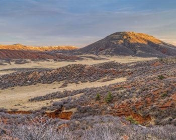
The property is surrounded by breathtaking Mountain Views including Mount Mestas & Rough Mountain, Little Sheep Mountain, Sheep Mountain, Greenhorn Mountain and the Sangre de Cristo Mountain Range.
This property is located in Game Management Unit 85. There were fresh wildlife droppings and tracks on the property as well as a Wildcat Den. The area is rich in native wildlife including Elk, Mule Deer, White Tail Deer, Pronghorn Antelope, Bear, Wild Turkey, Cottontail Rabbits and Dusky (Blue) Grouse.
Along the Northern Boundary there is 1,045 feet of Frontage along County Road 541. County Roads 541 & 540 will take you directly to State Highway 69, just 1.8 miles to the Northeast.
You are also only about 5 miles from the Badito Cone, Greenhorn Mountain and the San Isabel National Forest.
NO Hoa, Covenants or Restrictions. There is no time limit to build.
The minimum dwelling size per the County is only 600 square feet.
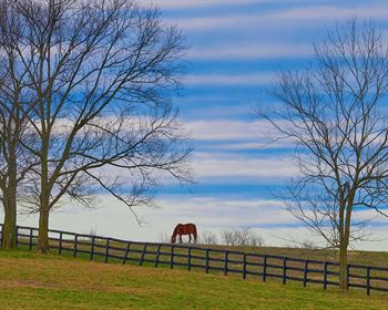
There are RVs, Cabins, Log Homes, Tiny Homes, Site-Built Homes, Mobile Homes and Ranches on nearby parcels (see photos).
Less than 6 miles to the town of Gardner, where you will find a school, post office, café, groceries and a church.
About 1.8 miles to paved State Highway 69 which takes you directly down to the town of Walsenburg 25 miles from the property, where you will find groceries, fuel, supplies, restaurants, medical care, schools and professional services.
The Spanish Peaks Regional Health Center in Walsenburg has a Level IV Trauma Center, specialty clinics and the 5 Star Rated Spanish Peaks Veterans Community Living Center.
Lathrop State Park is just Southeast of the property with about a 30 mile drive from this 70 acre property. Lathrop State Park is Colorado's first State Park and consists of 1,594 Acres. Nestled in the shadow of the Spanish Peaks, Lathrop State Park has two lakes; Martin Lake and Horseshoe Lake. Activities at Lathrop State Park include Boating, Swimming, Jet Skiing, Water Skiing, Camping, Fishing, Golfing, Archery, Hunting for Waterfowl and Small Game. For more information visit the park's Website.
Nearby land owners either install water wells, have it delivered or haul it themselves.
Parcel Size: 70 Acres M/L
Property ID Number: Co_Huerfano_00073
General Elevation: 6,800 feet
Legal Description: Cl&G Ranch Unit DD Lots 98 & 112
Apn: 17138112 & 1713898
Property Taxes: per year
Title: Free & Clear
Conveyance: Warranty Deed
Approximate Distance to Nearby Cities & Points of Interest
10 minutes to Gardner, CO : Population 354
12 minutes to Greenhorn Mountain, Badito Cone and the San Isabel National Forest
22 minutes to Interstate 25
30 minutes to Walsenburg, CO : Population 3,200
39 minutes to the Lathrop State Park
40 minutes to La Veta, CO : Population 800
59 minutes to Trinidad, CO : Population 10,000
1 hour 2 minutes to the Trinidad Lake State Park
58 minutes to Pueblo, CO : Population 110,000
1 hour 18 minutes to Lake Pueblo State Park
1 hour 38 minutes to the Great Sand Dunes National Park
1 hour 38 minutes to Colorado Springs, CO : Population 500,000
1 hour 53 minutes to Zapata Falls
1 hour 59 minute to Blanca Peak
2 hours 43 minutes to Denver, CO : Population over 1 Million
GPS Coordinates
Northwest Corner: 37.743202, -105.096012
Northeast Corner: 37.74273, -105.091598
Southeast Corner: 37.738408, -105.091613
Southwest Corner: 37.738422, -105.099141
Center Point: 37.740598, -105.094359
Call or Text anytime for questions or to purchase this property. Please reference the Property ID: Co_Huerfano_00073