Mountain View Ranch By Public Land
Bustos Canyon Rd : Walsenburg, CO 81089
Huerfano County, Colorado
Ranch Description
Call or Text anytime for questions or to purchase this property. Please reference the Property ID: Co_Huerfano_00033
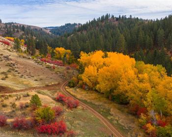
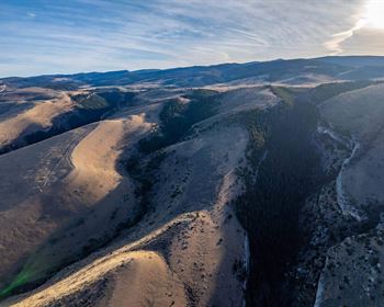
40.21 Acre Ranch in a private cul-de-sac with Mountain Views and County Road Frontage near Public Land containing the Cucharas River & Canyon.
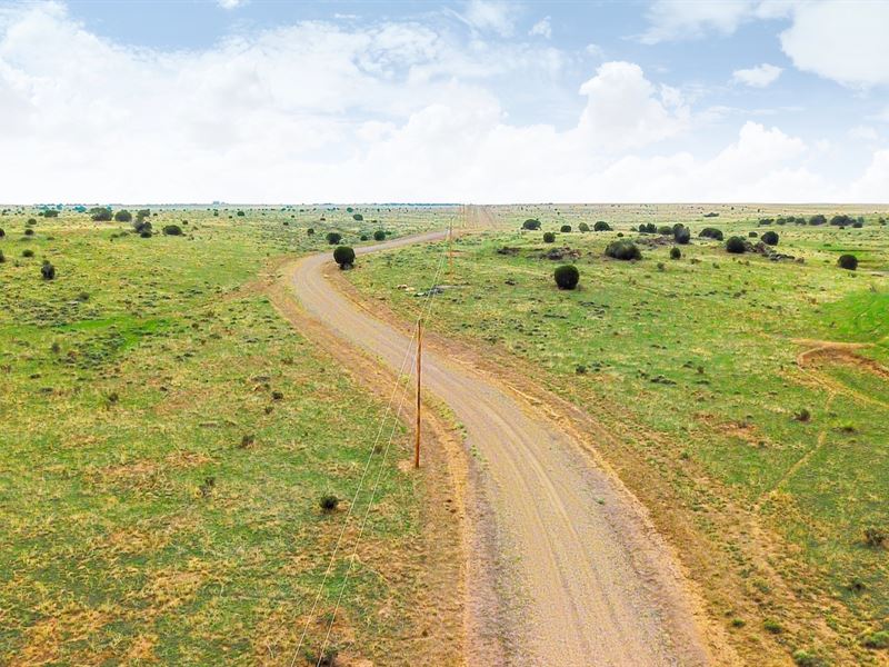
Electricity & Telecom can be found just a 0.25 mile North of the property on Bustos Canyon Road.
Just 2.5 miles to the East you will find 6,000 Acres of BLM Land that contains the Cucharas River and Cucharas Canyon. Activities include Hunting, Backpacking, Hiking, Wildlife Viewing, Bird Watching, Photography & More.
This property is located in Game Management Unit 128. There were fresh wildlife tracks on the property, as well as Antelope seen nearby. The area is rich in native wildlife including Bighorn Sheep, Black Bear, Elk, Mule Deer, White-Tailed Deer, Pronghorn & Mountain Lions.
To find more information on this GMU & hunting in Colorado, see the 2018-2019 Southeast Colorado Hunting Guide
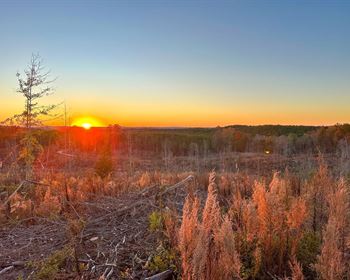
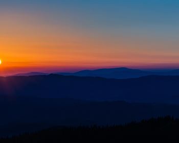
Enjoy big skies and unobstructed views of the surrounding area and nearby mountains.
The use of an RV, Motorhome, Camper, Pick-Up, Camp Trailer, Tent or other similar accommodation on the property is permitted for recreational purposes, just not for a permanent residence.
Permanent homes may be built along with accessory buildings.
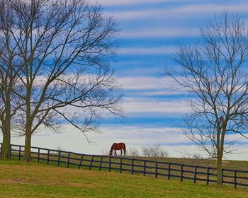
Horses, Cattle, Exotics and other animals are permitted.
1,200 square feet minimum for site built homes.
1,000 square feet minimum for double-wide manufactured / mobile homes.
Electricity is provided by San Isabel Electric
CenturyLink provides telephone & DSL Internet service
High-Speed Internet is available through HughesNet
Cable is available through DirecTV
There are homes, accessory buildings and ranches on nearby parcels in Turkey Ridge Ranch (see photos).
This property is only 41 minutes from Walsenburg, Colorado via maintained County and State roads. In the town of Walsenburg you will find groceries, supplies, medical care, schools and professional services.
The Spanish Peaks Regional Health Center in Walsenburg has a Level IV Trauma Center, specialty clinics and the 5 Star Rated Spanish Peaks Veterans Community Living Center.
Lathrop State Park is just South of Walsenburg and a 49 minute drive from the property. Lathrop State Park is Colorado's first State Park and consists of 1,594 Acres. Nestled in the shadow of the Spanish Peaks, Lathrop State Park has two lakes; Martin Lake and Horseshoe Lake. Activities at Lathrop State Park include Boating, Swimming, Jet Skiing, Water Skiing, Camping, Fishing, Golfing, Archery, Hunting for Waterfowl and Small Game.
The San Isabel National Forest is only about an hour from the property. The area features native wildlife including elk, deer, antelope and wild turkeys. The forest covers an area with a total of three million acres.
There is NO Time Limit to Build.
Power Company: San Isabel Electric
Multiple nearby land owners have successfully drilled water wells on their properties based on well permit data from the Colorado Division of Water Resources.
There is no time limit to build.
Turkey Ridge Ranch Covenants are available on the Website
Parcel Size: 40.21 Acres M/L
Elevation: 5,820 feet
Property ID: Co_Huerfano_00033
Legal Description: Turkey Ridge Ranch Filing No 1 Lot 19C
Property Taxes: / year
Title: Free & Clear
Conveyance: Warranty Deed
Approximate Distance to Nearby Cities & Points of Interest
2.5 miles to the boundary of 6,000 Acres of BLM Land that contains the Cucharas River and Cucharas Canyon
30 minutes to State Highway 10
35 minutes to Interstate 25
41 minutes to Walsenburg, CO : Population 3,200
49 minutes to the Lathrop State Park
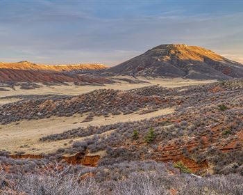
1 hour 7 minutes to Greenhorn Mountain, Badito Cone and the San Isabel National Forest
1 hour 13 minutes to Trinidad, CO : Population 10,000
1 hour 20 minutes to the Trinidad Lake State Park
1 hour 21 minutes to Pueblo, CO : Population 110,000
1 hour 28 minutes to the Lake Pueblo State Park
1 hour 58 minutes to Blanca Peak
2 hours to Colorado Springs, CO : Population around 500,000
2 hours to Great Sand Dunes National Park
2 hours 15 minutes to Zapata Falls
3 hours 3 minutes to Denver, CO : Population over 1 Million
GPS Coordinates
Northwest Corner: 37.287, -104.613158829167
Northeast Corner: 37.123, -104.608608134833
Southeast Corner: 37.256, -104.608554079502
Southwest Corner: 37.514, -104.613173506077
Center Point: 37.860347, -104.610865
Call or Text anytime for questions or to purchase this property. Please reference the Property ID: Co_Huerfano_00033