640 Acres - Trout Creek Highway 305
Highway 305 : Battle Mountain, NV 89820
Lander County, Nevada
Ranch Description
LEGAL DESCRIPTION:
Lander County, Nevada
SECTION 9 T29N R44E M.D.B.&M.
DRIVING DIRECTIONS:
From Battle Mountain exit Highway 305. Go south for approximately 19.50 miles until you reach Mill Creek Rd. or Martin Ranch Rd (called both). Go left or head east.1 miles and you arrive to the southwest corner of the property. It is that easy to find!!!
GPS COORDINATES:
N 40.393504
W -117.043157
These coordinates will take you to the southwest corner of section 9
PROPERTY is the total purchase price of the entire property! At a little over you won't find a better deal in Nevada for this type of parcel!!!!
Owner financing possible!
NO HIDDEN FEES. documentation/closing fee (This fee is for our attorney/escrow fees and covers all docs). Our escrows are handled through a firm in Elko, NV! NO HOA DUES OR ASSOCIATION DUES.
PROPERTY SIZE:
640 Acres - Approx. 27,878,400 sqft. +/- (1 square mile)
PROPERTY COMPARABLES:
These lots are being sold anywhere from - RESTRICTIONS:
There are no restrictions or time limits to build on this property. Call Lander County for any detailed questions. For more information feel free to contact Lander County Planning Department.
TITLE INFORMATION:
These parcels were purchased with title insurance and have a CLEAN TITLE.
SUBDIVISION INFORMATION:
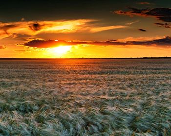
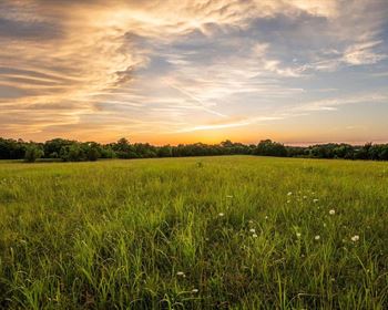
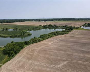
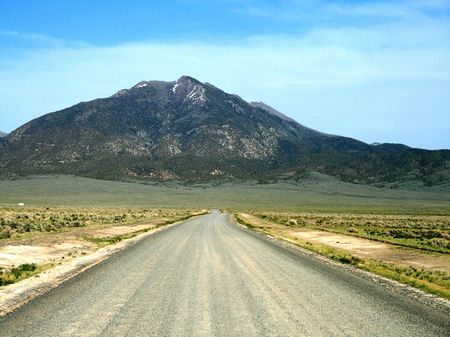
THERE IS A COUNTY MAINTAINED ROAD THAT THROUGH THE SOUTHERN PORTION OF THE PROPERTY (Jenkins Rd./Mill Creek Rd.) THERE IS ALSO A MAINTAINED DIRT ROAD RUNNING DIRECTLY NORTH OF THIS PARCEL ALONG WITH HIGHWAY 305 TO THE WEST OF THE PROPERTY. THIS PROPERTY ALSO ATTACHES TO A FEW 640 ACRES OF BLM LAND THAT CAN BE USED FOR RECREATIONAL PURPOSES. This property is accessible via a gravel road called Jenkins Rd. The property is flat to slightly rolling at the foothills of the beautiful Shoshone Mountain Range. Water by well at approximately 75-150 feet (residential wells permitted by the county). Power (and possibly phone are located just west of the southwest corner, although alternative energy is also another possibility and is used throughout the area. There are county dirt roads and BLM roads (Bureau of Land Management) throughout the area. The property is located approximately 19.50 miles south of Battle Mountain, 75 miles east of Winnemucca, 86 miles west of Elko and 13 miles south of Interstate 80, the main corridor through Northern Nevada.
Mineral rights have been obtained by federal and/or state agencies or previous owners for many years in a large amount of the sections of rural land that we sell. It is extremely uncommon to find large tracts of rural land that include mineral rights. Mineral rights do not add value to any of the properties that are sold and therefore not transferred with the sale of this property. If you are interested in owning these rights there may be a possibility of purchasing them.
PROPERTY TAX:
Approximately per year and paid current through 2009. Buyer will be billed this amount once a year.
CONVEYANCE DOCUMENT:
This parcel will be sold via a Land Contract. Once paid off it will be deeded over via a Grant, Bargain, Sale Deed.
CLOSING FEES AND INFORMATION:
The only closing fees of this auction is high bid, plus the documentation/closing fee. No other fees are assessed upon closing. The only yearly fees are the property taxes. We accept Cashiers Checks, Wire Transfers, Personal Checks and Paypal, although Paypal has a one time limit of CHALLENGE TO YOU:
We challenge anyone to find buildable property, with this type of growth potential anywhere in AMERICA for less than "THERE WILL NEVER BE MORE LAND, BUT THERE WILL ALWAYS BE MORE PEOPLE."
Surrounding Area
Battle Mountain, Nevada:
Elevation 4,500 ft.
Avg. Ann. Precip. 8.8 in
Avg. Temp. in January High 43 Low 17
Avg. Temp. in July High 96 Low 51
Distance to Major Cities:
Winnemucca, NV - 65 miles
Elko, NV - 80 miles
Reno, NV- 219 miles
Salt Lake City, UT - 301 miles
Boise, ID - 310 miles
Sacramento, CA - 350 miles
*All figures shown are approximate values.
Transportation Major Highways:
Interstate 80 Westbound - Reno, NV
Eastbound - Salt Lake City, UT
U.S. Highway 95 Southbound - Las Vegas, NV
Northbound - Boise, ID
Airport:
Lander County Municipal Airport - 7,300 ft. runway
Elko Airport - 80 miles