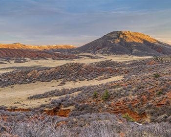
80 Acres in Malheur County, OR
Jordan Valley, OR 97910
Malheur County, Oregon
Ranch Description
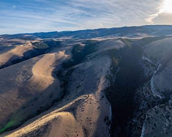
80 acres of raw land well off the beaten path, located in Jordan Valley in South Eastern Oregon. This extremely isolated and rural property is roughly 18 miles off of Hwy 95 and adjacent to plenty of BLM land; ideal for a true getaway of camping, hiking or other outdoor activities. Located in Malheur County this parcel is zoned for range use only, so it's also ideal for hunting, camping, or farming. 320 acres are required to place a dwelling on parcels in this zone.
Parcel Snapshot:
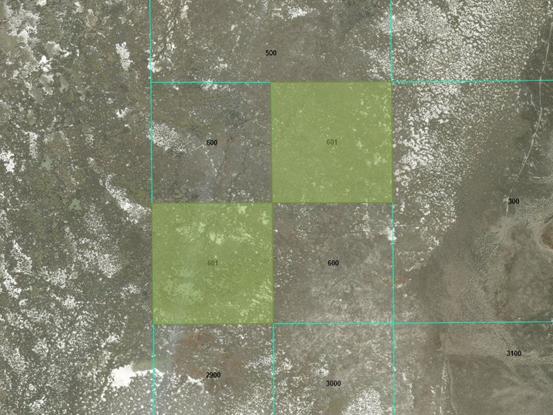
Map: 35S37
Tax Lot: 601
Gps Marker: 42.52726, -118.11744
Legal Description: Lot 601 IN Twp. 35S., R 37 E. W.M. Sec.2, NE 1/4 Se1/4 And Sw1/4 SE 1/4
Current Zoning: C-A2 Exclusive Range Use
Tax Classification: 500
Size: 80 acres (2 Diagonally Adjacent 40 Acre Lots)
Terrain: Varied
Elevation: 4125Ft
Power/Water: Rural / Off-Grid
Roads: Dirt
Property Taxes: Fees: N/A
Finance Terms
Purchase Price: Rate: (8%)
Loan Term: 15 Years
Monthly Payment: Due Today
Down Payment: Fee: Today: Payment:
Land Payment: Tax: Assoc. Fees: Servicing Fee: Monthly Payment: sure to reference L100266-1 in any down payment and document fee for lot L100266-1. Your welcome packet, contract, and payment coupon book for your monthly payments will be sent to the shipping address you provide. (Please note that we do charge a shipping fee.)