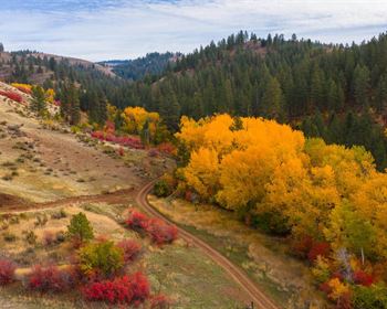
Twin Brooks Woodland
Nellie Chase Road : Middlesex, VT 05682
Washington County, Vermont
Ranch Description
Twin Brooks Woodland is an ideally located building property with close views of the Worcester Range after clearing, two mountain brooks, a private island and a quiet and peaceful setting. The property is in the town of Middlesex, Vermont, where outdoor recreation is easily accessible. The Worcester Range with several notable peaks is in the town as is Wrightsville Reservoir, a 190-acre impoundment of the North Branch of the Winooski River. The woodland is one mile from the local school, 2 miles to a popular trailhead and 8 miles to downtown Montpelier. Burlington, Vermont's largest city, is 1 hour to the north, while Boston and Montreal are within a 3-hour drive to the southeast and northwest, respectively.
Twin Brooks Woodland is the next-to-last property on Nellie Chase Road, a town-maintained gravel road. Overall, the terrain is a gentle slope from west to east with numerous level areas. Old internal roads can easily be converted to walking and cross country ski trails. Soils are generally well-drained with areas of poorly drained soils, particularly in the southwest corner and in the far eastern section.
The forest resource consists of a hardwood and softwoods species mix, with semi-open areas in the center of the property. Most of the forest has naturally reverted from old field abandonment roughly 35 years ago, resulting in a forest age structure that is relatively young. Older trees can be found along the brooks. With clearing in the right places, close views of several peaks of the Worcester Range as well as two local hills to the west can be enjoyed. Within the view sheds, there are no houses or other signs of development.
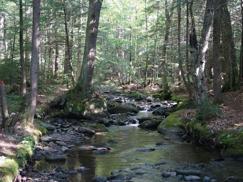
Two mountain brooks form the northern and some of the eastern borders of the property. Both originate in the Worcester Mountains and run year-round. White Brook flows along the northern border of the property to the northeast corner, where it branches into two channels. Patterson Brook joins the flow and continues along the eastern boundary for 1,000 ft before diverging away from the property.